


ROSAMOND Voting District, Christian County, Illinois
About
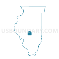
Outline

Summary
| Unique Area Identifier | 564852 |
| Name | ROSAMOND Voting District |
| County | Christian County |
| State | Illinois |
| Area (square miles) | 36.03 |
| Land Area (square miles) | 36.03 |
| Water Area (square miles) | 0.00 |
| % of Land Area | 100.00 |
| % of Water Area | 0.00 |
| Latitude of the Internal Point | 39.39260050 |
| Longtitude of the Internal Point | -89.19491030 |
Maps


Graphs
Select a template below for downloading or customizing gragh for ROSAMOND Voting District, Christian County, Illinois


Neighbors
Neighoring Voting District (by Name) Neighboring Voting District on the Map
- AUDUBON 1 Voting District, Montgomery County, IL
- GREENWOOD Voting District, Christian County, IL
- JOHNSON Voting District, Christian County, IL
- LOCUST Voting District, Christian County, IL
- NOKOMIS 4 Voting District, Montgomery County, IL
- OCONEE Voting District, Shelby County, IL
- PANA 3 Voting District, Christian County, IL
- PANA 4 Voting District, Christian County, IL
Top 10 Neighboring County Subdivision (by Population) Neighboring County Subdivision on the Map
- Pana township, Christian County, IL (6,647)
- Nokomis township, Montgomery County, IL (2,939)
- Locust township, Christian County, IL (1,825)
- Oconee township, Shelby County, IL (776)
- Johnson township, Christian County, IL (673)
- Audubon township, Montgomery County, IL (552)
- Rosamond township, Christian County, IL (421)
- Greenwood township, Christian County, IL (208)
Top 10 Neighboring Place (by Population) Neighboring Place on the Map
Top 10 Neighboring Unified School District (by Population) Neighboring Unified School District on the Map
- Taylorville Community Unit School District 3, IL (18,866)
- Pana Community Unit School District 8, IL (9,590)
- Nokomis Community Unit School District 22, IL (4,349)
Top 10 Neighboring State Legislative District Lower Chamber (by Population) Neighboring State Legislative District Lower Chamber on the Map
Top 10 Neighboring State Legislative District Upper Chamber (by Population) Neighboring State Legislative District Upper Chamber on the Map
Top 10 Neighboring 111th Congressional District (by Population) Neighboring 111th Congressional District on the Map
Top 10 Neighboring Census Tract (by Population) Neighboring Census Tract on the Map
- Census Tract 9587, Christian County, IL (4,750)
- Census Tract 9590, Christian County, IL (4,650)
- Census Tract 9573, Montgomery County, IL (3,483)
- Census Tract 9596, Shelby County, IL (3,416)